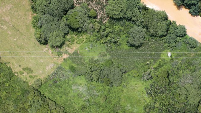
Tower mapping assists utilities in the identification of structural and maintenance issues in existing towers, as well as during the pre-construction phase of new transmission lines and towers. Often, tower owners end up discovering tenants that they did not know were on their structures, as well as vegetation that might have grown on their assets, through accurate mapping. Surveillance and monitoring techniques aid in selecting the right tower foundations based on the topography and soil type of the area and provide the necessary assistance in determining the number of transmission towers required for laying a transmission line through the shortest route possible.
Over the years, many tower owners have experienced inaccurate mapping from companies that did not have the necessary organisational and technological skills to assemble the available data correctly. Utilising a perfect mix of artificial intelligence and internet of things (IoT), many tower monitoring solutions today are enabling owners to monitor tower sites from a centralised location. The use of sensors, connected devices, and tower mapping and monitoring techniques makes it easier for utilities to monitor and control their assets remotely, regardless of their geographic location. Utilities are increasingly adopting advanced technological tools for tower mapping.
Emerging technologies
Conventional surveying techniques are both time-consuming and inaccurate. Therefore, utilities have adopted advanced technological tools for tower mapping and surveillance, such as aerial patrolling solutions, geographic information system (GIS) mapping and light detection and ranging (LiDAR).
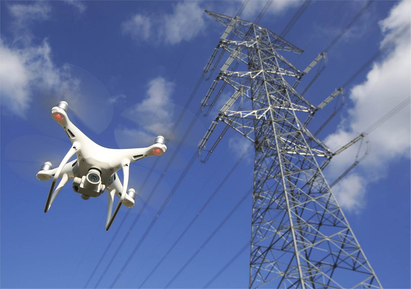
Patrolling devices, using unmanned aerial vehicles (UAVs)/drones, eliminate the need to physically visit the tower site. They are equipped with gimbal-mounted ultra-HD video cameras that can take high-resolution photographs and videos. The use of helicopters/drones equipped with gimbal-mounted LiDAR thermo-vision cameras and high resolution video and digital cameras to provide high resolution images of towers and project sites has also gained traction over time. These methods are not only cost effective, but also more efficient than conventional solutions. Drone patrolling provides valuable information related to the tower top and is also being used by transmission utilities for assessing potential site locations, designing site layouts, generating 3D visualisations and making right-of-way (RoW) estimations.
LiDAR is another essential method for carrying out aerial surveys. It plays a crucial role in optimising route corridors for transmission lines and determining the position of towers through topographic mapping. The data processed through a LiDAR survey can be directly linked to a modelling software, which can provide options for alignments, tower designs and tower positions at minimal cost. In addition, LiDAR effectively captures natural and artificial objects under and around transmission lines, providing information that can be used for understanding tower locations as well as the structural quality of towers. This helps in determining catenary models of lines, undertaking vegetative critical distance analysis, and carrying out repair and planning work in a transmission line corridor.
GIS-based corridor mapping tools are also being used for transmission asset mapping and route alignment during the planning of new transmission lines, as well as for conducting vulnerability analyses during events such as floods and fires. Mobile app-based inspection solutions will also go a long way in helping utilities locate and monitor the complex electrical grid in real time. Such apps allow towers to be identified based on their GPS location and provide biometrics-based authentication for maintenance engineers. The use of UAVs/ drones and GIS-based corridor mapping helps in accurate and detailed pre-construction surveys, which are useful for minimising RoW requirements – one of the major constraints in transmission network expansion.
Utility initiatives
 Power Grid Corporation of India Limited (Powergrid) has deployed helicopters equipped with gimbal-mounted LiDAR, thermovision cameras, corona cameras and high resolution video and digital cameras for operations and maintenance (O&M) of transmission lines and towers. Through aerial patrolling, Powergrid can cover 100-150 route km in a single day. Faults such as infringement of safety clearances by trees/bushes, adjacent side objects and broken insulators can be easily identified through aerial patrolling. Critical faults such as hotspots can be identified using thermo-vision techniques. Powergrid also uses drones to patrol and survey its transmission line infrastructure. Drone patrolling provides the transco with detailed information about the tower top, such as the condition of the insulator, the earth peak and the earth wire.
Since 2020, Maharashtra State Electricity Transmission Company Limited has also started using drones for the inspection and maintenance of transmission lines. The O&M works of extra high voltage lines including ground patrolling, tower top patrolling and surveys are being conducted through drones monitored at a centralised location. The drones are equipped with video cameras and thermovision cameras, which help in immediate detection of faults in transmission lines, aiding in speedy repairs. The transco plans to use drone cameras for surveys in new projects as well.
Sterlite Power deployed LiDAR technology to conduct topographical mapping during the construction of the Bhopal-Dhule transmission project, executed by its subsidiary Bhopal Dhule Transmission Company Limited. According to the company, LiDAR beams transmitted from the aircraft helped Sterlite Power in overcast and cloudy conditions, providing high precision at a high speed. With the use of these technologies, the risk of project execution was significantly reduced. Sterlite Power is also utilising LiDAR technology to conduct topographical mapping in the under-construction Udupi-Kasargode transmission project. The company also deployed aerial technology in the NRSS-29 transmission project in 2018 to overcome some of the toughest challenges of the Kashmir Valley. Helicranes, used for the first time in Asia, were deployed to deliver over 3,500 tonnes of material to the site safely. In addition, drones and helicopters were used in wire stringing and providing aerial surveillance. Adani Transmission utilises drone inspection for asset maintenance, as well as LiDAR technology for pre-bid surveys.
The way forward
New and emerging survey and patrolling techniques enhance the operational efficiency of transmission assets by minimising unexpected equipment downtime. With integrated artificial intelligence capabilities, the data collected from IoT sensors and connected devices can be presented via detailed charts and reports to help the user identify patterns or similarities in order to make better decisions. In other words, they provide solutions that can help industries in identifying patterns and anomalies for predictive maintenance planning. Connected devices and sensors enable utility owners to track power sources and monitor their assets.
The transmission network is expected to grow significantly in the coming years with the expected integration of large-scale renewables into the grid. This wo-uld require utilities, especially at the state level, to come forward and adopt advanced mapping and surveillance solutions in order to expedite transmission project development, as well as ensure efficiency of existing lines and towers. In order to encourage state utilities to come forward and deploy drones, UAVs and LiDAR, the central government needs to streamline rules and regulations for their deployment.
